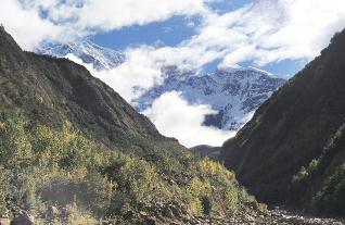
The eastern Himalayan syntaxis (convergence of mountain ranges, or geological folds), a gorge along the Parlung river in Tibet, is tectonically active. The coincidence of high mountains and strong rivers that cause erosion makes it a good place to study the role of surface activity, such as erosion, in controlling tectonics. A recent study, published on August 18 in Science, finds that the syntaxis is moving northwards.
This contradicts a belief that the surface erosion due to the powerful river and other factors would pin the high-erosion zone to its location. For this purpose the researchers use a new technique called Optically Stimulated Luminescence (OSL) thermochronometry.
In general, the topography of mountain ranges comes to be as a result of various factors such as tectonics, climate and surface processes. In this context, the study contributes to a debate about the relevance of surface processes such as river erosion and other activities to tectonics. Georgina King, Head of the Cologne Luminescence Laboratory, University of Cologne, and the lead author of the paper, explains in an email: “The control of tectonics by surface processes was thought to be demonstrated by pinning of a high erosion zone by the very erosive rivers. Our new data show that this zone was not pinned, but rather continued to migrate northwards.”
The eastern Himalayan syntaxis is an ideal location to study the effects of erosion on tectonics — very tall mountains over 7,000 metres high and powerful rivers. Because the surface processes are so intense, the erosion is rapid. As Dr. King puts it, “If surface processes are able to control tectonics, we would expect to be able to record it here.” The researchers used a new technique to measure the migration of the fold of land known as OSL thermo chronometry. As rocks get “exhumed,” or rise to the surface from the earth’s crust, they start cooling down. At specific temperatures, the minerals such as quartz contained in the rocks start capturing electrons while continuing to rise, and they cool correspondingly. By observing the history of concentrations of electrons, the researchers estimate the temperature profile against the time and then translate this into knowledge of the depth as a function of time. This gives them an understanding of the rate at which the rocks rose to the surface.
The researchers made their measurements at five regions along the Parlung River which were across the northern end of the exhuming area, and three regions to the south. While the samples from the northern regions were in the range of 30 to 150 thousand years, the ones from the south yielded ages of about 200,000 years. This variation was crucial in inferring the drift.
Dr King explains, “We contrasted our new OSL data with data from existing studies, based on other thermochronometers. Our new data showed that the rate of erosion had increased in the last 1 million years, to rates which could not be explained simply by river incision. Instead we needed tectonic uplift as well to explain our data. We looked at previous studies on the wider geological context, which indicate continued northward migration of the dome, which our data are consistent with.”


Leave a comment